

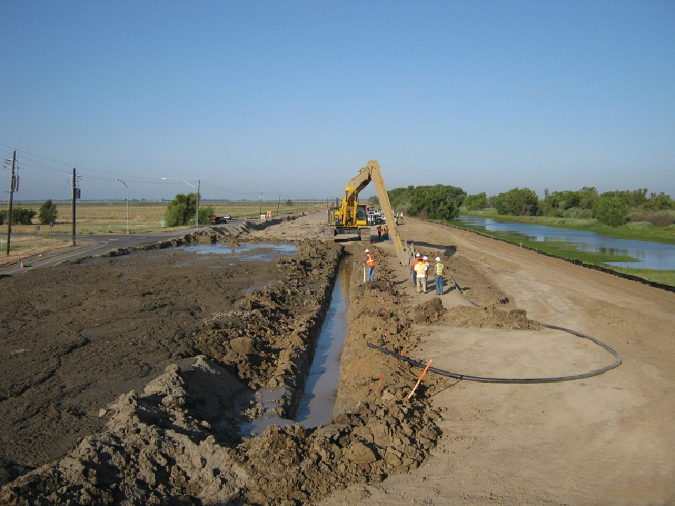
In 2017, Wood Rodgers was contracted by the Three Rivers Levee Improvement Authority to provide civil engineering design services for the Goldfields 200-year setback levee. The setback levee provides 200-year protection to the areas south of the Yuba River and east of the Feather River in Reclamation District 784. The Project consisted of 3.5 miles of new setback levee including seepage mitigation design (cutoff walls and seepage berm), borrow sources, and drainage and two water supply facilities crossing the levee alignment – a double 5x8 box water supply culvert and 36-inch drainage culvert.
The borrow sites were converted into interior drainage facilities to limit post-project impacts on existing local drainage. Utility relocations were coordinated through PG&E, the Yuba County Water Authority, and others. The project was funded by way of the California DWR Urban Flood Risk Reduction (UFRR) Program. Wood Rodgers also provided Construction Management services during construction including Resident Engineering, Office Engineering and preparation of the Construction Completion Report.


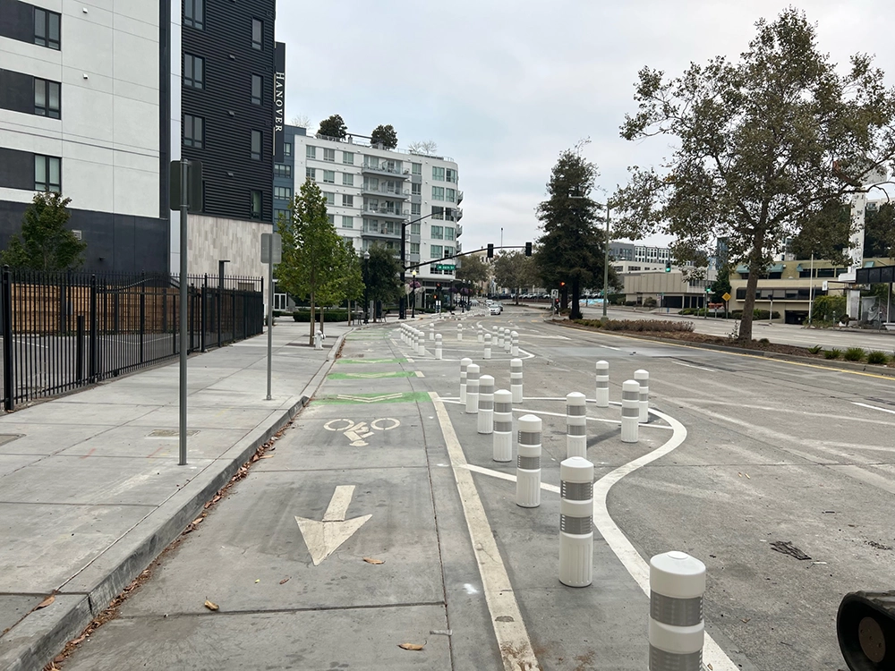
The 27th Street Complete Streets Project in Oakland, CA aims to transform the existing corridor into a safe and accessible thoroughfare for all users. By integrating a comprehensive approach, the project involves the design of a complete street corridor, incorporating various hardscape elements such as protected bike lanes, strategically improved intersections, and upgraded traffic signals. Bicycle and pedestrian safety was a top priority, and extensive sidewalk repairs were undertaken to ensure smooth and hazard-free pathways. Inclusivity was a key consideration throughout the project. A thorough assessment of the existing features was conducted, with a particular focus on evaluating curb ramps for compliance with ADA standards. Additionally, deteriorated sections of curb, gutter, and sidewalk were identified for replacement, enhancing the overall accessibility of the street. To meet the highest standards, the project is adhering to more stringent design guidelines set forth by City programs such as the ADA Compliance Program, Bike and Pedestrian Program, and the Complete Streets Division. By aligning with these initiatives, the 27th Street Complete Streets Project demonstrates the City’s commitment to creating a sustainable, people-centric transportation network that fosters healthier, greener, and more connected communities.

Wood Rodgers partnered with the RTC to develop the final design for a Bus Rapid Transit Extension Project, securing federal funding through FTA TIGER and Small Starts grants. The project aims to transform transportation in an old-town area, necessitating complex design solutions. This includes sidewalk replacements, street adjustments, and improved accessibility for pedestrians, cyclists, and various transport modes.
Additionally, the project focuses on designing transit stations that resonate with the area's historic charm, integrating the locality's history into the fabric of the proposed architecture. Wood Rodgers leads this endeavor, providing comprehensive transportation design, surveying, grant assistance, public outreach, and other essential services, earning recognition with the 2019 ASCE Truckee Meadows Branch Project of The Year Award.
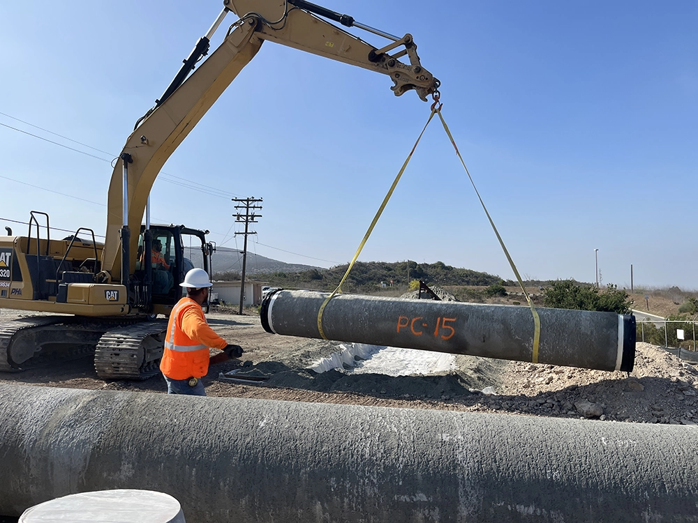
The Otay Water District provides water service to customers within a 125 square mile area of southeastern San Diego County. One of the District’s largest pressure zones is served by the District’s 11 million gallon (MG) 870-1 reservoir, which is the sole storage reservoir for the pressure zone. Wood Rodgers designed the District’s new 3.4 MG 870-2 Reservoir to allow the District to take the existing 11 (MG) earthen embankment 870-1 reservoir offline for maintenance to allow for the replacement of the floating cover/liner on this reservoir. In addition to the design of the new 870-2 Reservoir, Wood Rodgers provided additional site and mechanical improvements which included the relocation of the 870-1 inlet, which must relocated in such a manner to avoid a complex network of proposed and existing yard piping which includes a 30-inch steel inlet, 30-inch steel outlet, and a 30-inch reinforced concrete storm drain and overflow pipe.
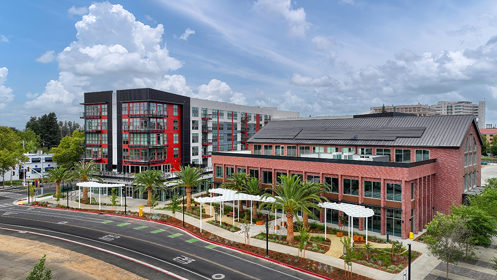
UC Davis Aggie Square is a three story, 40,000 sq ft building adjacent to the UC Davis Medical Center in Sacramento, designed to support a mix of office and research laboratory tenants. Wood Rodgers assumed the role of structural engineer in February 2022 after schematic design, though the project experienced a six month pause while the Owner and University evaluated building use and configuration. Design resumed in late November, leading to a Design Development package by year end and final Construction Documents in mid 2023. The building uses structural steel framing with concrete filled metal decking and a spread footing/grade beam foundation system. Significant revisions were made to the lateral system, replacing a mixed braced frame and cantilever column arrangement with a full braced frame system on the upper level to satisfy peer review concerns and maintain lower seismic loads. The team optimized gravity framing, foundations, and steel connections, and designed large steel gable trusses fabricated in two sections, along with cold formed curtain walls, entry canopies, rooftop equipment framing, and structural support for electrical transformers, coordinating closely with all design disciplines.

The Alameda County Flood Control and Water Conservation District (District) entrusted Wood Rodgers with a comprehensive assessment of its 24 flood control pump stations. Our team utilized Infoworks ICM to create detailed floodplain maps and developed calibrated hydrologic and hydraulic models for each station, identifying flood risks accurately. Through pump flow testing and in-depth inspections, we uncovered discrepancies between actual and manufacturer pump curves, crucial for determining 100-year flood capacity.
The project's meticulous approach extended to engine oil tests, infrared imaging, and vibration testing, providing insights into wear, potential issues, and overall system health. This thorough analysis allowed us to prioritize pump station rehabilitation, reducing flooding risk significantly. Our risk-based analysis compared costs for maintaining existing service levels versus improving to a higher level, aiding in informed decision-making.
Wood Rodgers recommended efficient combinations of reoperation, maintenance, rehabilitation, and improvements for all 24 pump stations. By defining consistent methods to prioritize needs and enhancing operations and maintenance procedures, our project ensures a resilient and effective flood control system for the Alameda County community.

Wood Rodgers provided aerial mapping services for this 6,000-acre former copper mine, the Anaconda Mine site. The Anaconda mine has a productive mining history, but recently has a trouble past of environmental neglect. Aerial topographic and planimetric mapping, along with orthorectified imagery was provided to develop maps being used for environmental remediation and clean-up. An unmanned Aerial System (UAS) was used to collect survey-grade data in the difficult and variable terrain where traditional survey methods would cause safety issues and lengthy delivery times. Our team was able to save time, save budget, develop methods to accomplish the task(s) under adverse conditions, with data that is verified by licensed land surveyors and certified photogrammetrists. The environmental clean-up of this site has been in the public eye and Wood Rodgers sincerely hopes these mapping products will help engineers mitigate the adverse conditions at this mine and the surrounding community.

This $23 million LEED Platinum building in the unincorporated Ashland community was funded by Alameda County with redevelopment funds hours before the state disbanded the agencies last year. It sits on an acre of land on East 14th Street once used as a fuel storage facility, now cleared of toxins, in a community plagued by eighth-grade dropouts and teen pregnancies. Wood Rodgers provided land surveying, civil engineering and landscape architecture services. The project included a 30,000 square foot community center, parking lot, café, day care, medical offices, playground area, and small amphitheater. A key feature of the design was incorporation of low impact development (LID) features to meet the regional stormwater quality. These elements included a green roof, flow through planters, vegetated buffer strips, bio-swales, and pervious pavers. The landscape design was in accordance with the Bay Friendly Landscape Guidelines, and Wood Rodgers facilitated approval of the project . Wood Rodgers also facilitated obtainment of an encroachment permit from Caltrans for the fronting roadway work.
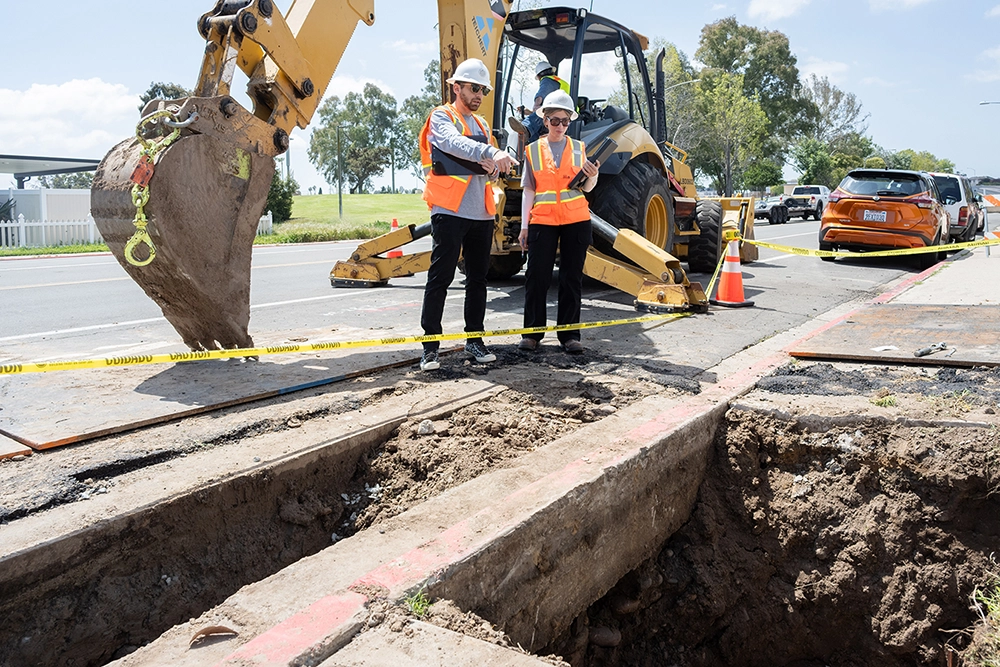
Wood Rodgers was awarded a $7.5M, five-year as-needed engineering services contract by the City of San Diego’s Transportation Department, which maintains infrastructure for 1.3 million residents. To date, Wood Rodgers has serviced seven task orders, which have included traffic control plans, asset management, public outreach, utility undergrounding, financial analysis, coastal engineering, urban forestry, and pavement management. Task orders relevant to this RFP have included:
Task Order 1 Communication Support Services: This task order included preparing monthly Director’s Reports, preparing Committee and Council presentations, branding of both internal and external documents and reports, and developing educational graphics.
Task Order 2 Traffic Control Plan Services: Wood Rodgers prepared 25 custom traffic control plans to support pavement rehabilitation across 19 slurry seal and 6 restoration sites citywide. These locations, within Caltrans right-of-way, required an encroachment permit, ensuring the successful execution of each project.
Task Order 3 Utility Undergrounding Program Support: Wood Rodgers supports San Diego’s Utilities Undergrounding Program by overseeing project prioritization, planning, financial forecasting, permitting, and compliance. Services also include public reporting, messaging strategies, customer service management, communication support, pace and sequencing, and community forum preparation and participation. As part of this task order, Wood Rodgers developed a custom forecasting tool (displayed below) for UUP staff to use for budget tracking; this tool allows them to track both their total budget and that of each project, and forecast when future projects can begin. Sensitive information has been removed from the image.

Wood Rodgers Landscape Architecture provided design and improvement plan services for this 37,500 SF Air Force facility which contained over two acres of landscape area. The landscape plans included design, theming, and material selection of three age-specific outdoor play environments. All three environments were designed with a nature theme to stimulate outdoor play at a young age.
The nature theme includes log balance beams, hollow tree trunk tunnels, boulders and stumps to step across, and the use of berms as a slide.
Our team of landscape architects took great pride in creating a one-of-a-kind facility that focuses on providing a unique themed play experience for children regardless of age or ability.
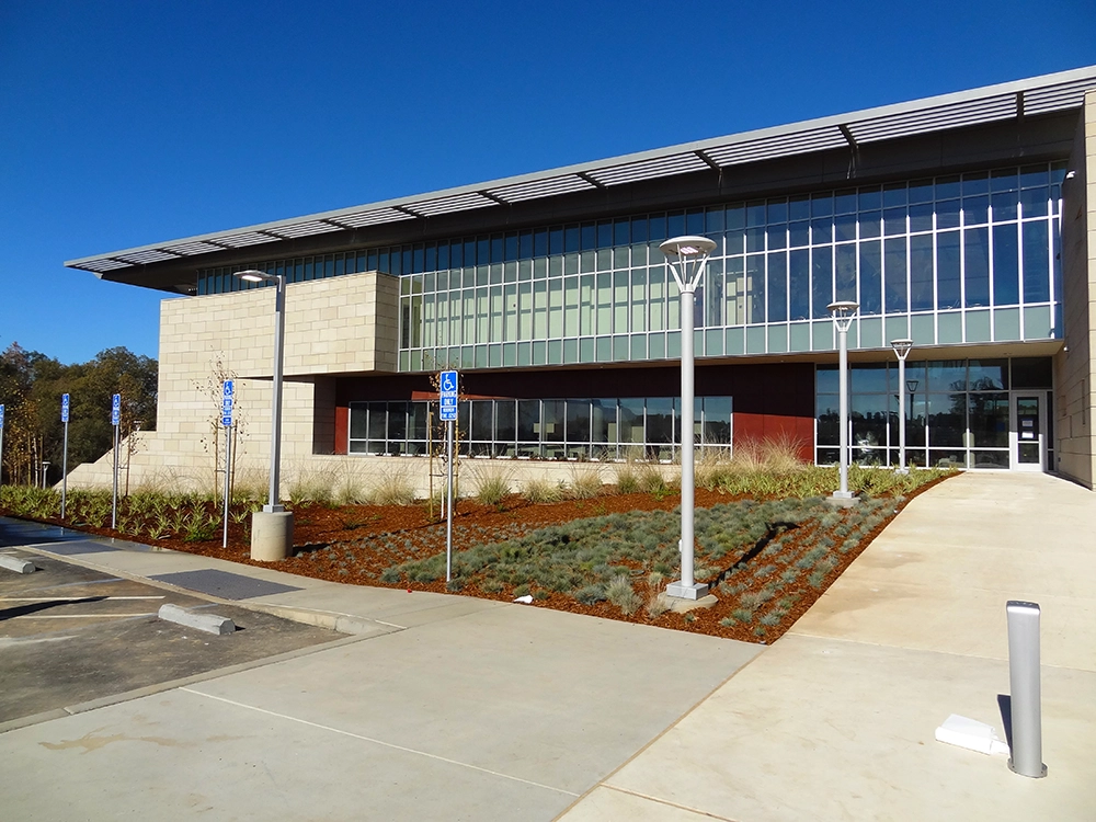
Wood Rodgers Landscape Architecture provided conceptual landscape design, improvement plan services, and construction assistance for this new courthouse containing over two acres of landscape area. The landscape was designed to blend into the natural oak meadows surrounding the site through the use of native hydroseeds and groundcovers. The site consists of public and private parking lots, bioswales, landscaping adjacent to the building, a rooftop garden, and perimeter landscape blending back into the natural environment. Wood Rodgers worked with the architect to develop a sufficient soil cross section, locate a water source, and appropriately plant the roof top garden. The parking lot was designed to drain into the landscaped medians as a way to reduce overall site runoff. Wood Rodgers also provided construction assistance for the project which was completed in summer of 2012. This project is expected to receive a LEED silver rating.
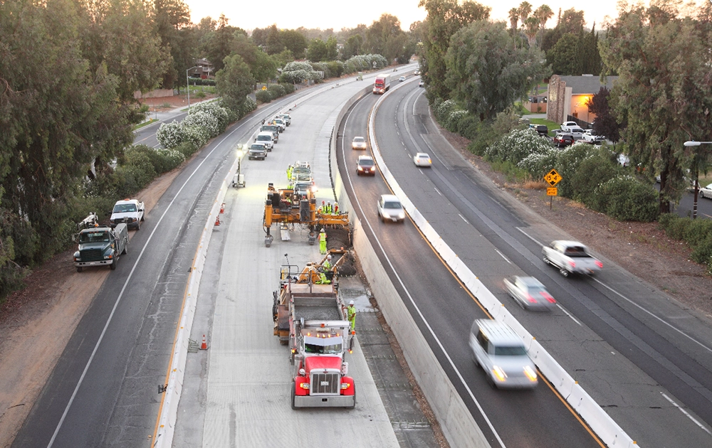
This project proposes to construct two auxiliary lanes on southbound State Route 99 (SR 99) in Elk Grove, Sacramento County, California, between PM 12.7 and 16.3 to improve weaving and merging operations. The proposed auxiliary lanes will reduce traffic congestion by reducing weaving of traffic and will enhance traffic flow through this corridor. Caltrans Freeway Operations has identified the need for auxiliary lanes at the following locations:
1. Southbound-99 Southbound Calvine Road / Cosumnes River Boulevard to Sheldon Road
2. Southbound-99 Southbound Laguna Boulevard / Bond Road to Elk Grove Boulevard
Project activities include the construction of auxiliary lanes, installation of ramp meters, replacement of median barriers, and culvert augmentations. The removal of existing chain-link fencing, construction of a concrete barrier, and the repositioning of overhead signs are anticipated between the southbound SR 99 lanes and West Stockton Boulevard (Blvd.). Five (5) on-ramp meters will be upgraded on northbound (NB) SR 99 at various locations within the existing ramp areas.
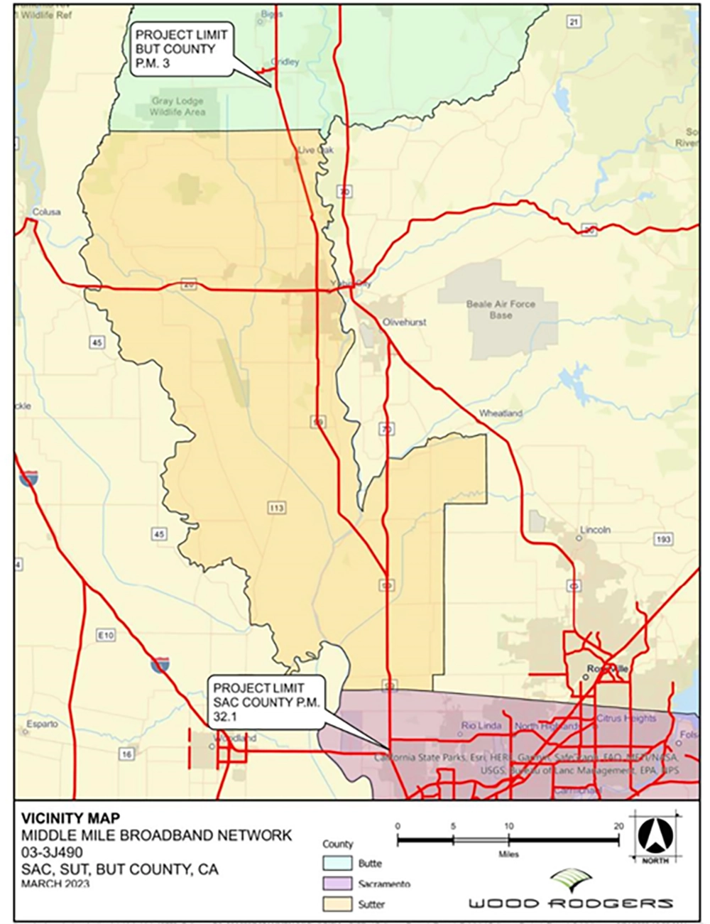
Wood Rodgers was responsible for designing fiber optic cable installation along 111 miles of freeways and state highways requiring over 500 design plan sheets. Itemized sheet quantity takeoffs and summary tabulations for each design sheet were required with the final deliverable being in MicroStation DGN file format. A project of this magnitude would typically take nine months to complete manually with a team of eight full-time employees. Wood Rodgers was able to complete the project successfully within its six-week deadline with ten engineers and six technology staff using GIS and automation. Wood Rodgers was able to overcome the challenges faced in this project by leveraging the use of technology and viewing it as a data management project instead of a traditional design project. The design elements for this project were simple but the size of the data and collaboration requirement were significant. Wood Rodgers leveraged IT, CAD Design, and GIS technologies to develop solutions to help improve the collaboration, efficiencies and productivity of the design and management teams. This project was awarded a Special Achievement Award in GIS at the Esri International User Conference in 2024.

Wood Rodgers was selected for this project to restore damaged roadway and culvert on Canyon View and Utica Drive in Calaveras County that was damaged during the 2017 winter storms. The project included review the scope of work provided by the California Governor’s Office of Emergency Services (CalOES) and the Federal Emergency Management Agency (FEMA) to return the facility to pre-disaster conditions and determine if an alternative reasonable repair strategy is warranted. Tasks include completing project development work, including environmental, permitting, right-of-way needs, utility coordination, design and other necessary supporting services to provide 100% PS&E package suitable for the County to issue a Notice to Bidders. Innovations included use of UAS/LIDAR to survey downslope area deemed dangerous for conventional survey methods. Additional Design Documentation memo prepared to change repair scope in Project Worksheet from a soil slope “infill” repair to a soldier pile wall with tie-backs. This project is one of five remaining projects to restore damaged roads and culverts in specific locations that suffered damage as a result of the 2017 Winter Storms – Federal Declaration DR 4308 (dates of incidents: 1/3/17 – 1/12/17 and 2/1/17 – 2/23/17). The repair of these road and culvert locations is funded under the California Governor’s Office of Emergency Services (CalOES) through the California Disaster Assistance Act (CDAA). Portions of the work qualify for funding under Federal Emergency Management Agency’s (FEMA) Disaster Assistance. Project design successfully completed in 2020 and construction was completed in 2021.

Wood Rodgers is responsible for the environmental clearance and final design of improvements to the along Carlsbad Boulevard, inclusive of the Tamarack Avenue intersection. Enhancements include the additional of buffered bike lanes, wider sidewalks, and a single-lane roundabout within the intersection. The study intersection is located approximately ¾-mile south of Carlsbad Village Drive and approximately 750 feet north of Agua Hedionda Lagoon.
The City has identified the need to upgrade the corridor to improve pedestrian mobility and bus stop access, and to address narrow sidewalks and the absence of crosswalks. The roundabout would improve the flow of multi-modal traffic, increase the perceived and actual safety of bicyclists and pedestrians, and improve the aesthetics of the intersection and surrounding coastal area. Carlsbad Boulevard is bounded on the west by Carlsbad State Beach and the Pacific Ocean and on the east by a mix of residential homes, restaurants, rental properties, and businesses.

Wood Rodgers was selected through a competitive qualifications based process to design, permit and administer the construction of a new 10.5 acre CarMax auto dealership to be located on Reno Sparks Indian Colony land in south Reno. The project includes the construction of three separate buildings on-site, civil improvements in support of the buildings, as well as an extensive utility network to connect them. The project presented unique challenges as it is a redevelopment site, which required extensive coordination with numerous agencies and with the RSIC to prepare the site for development and to allow for future development on the adjoining properties.

Vision Zero is a strategy to eliminate all traffic fatalities and severe injuries, while increasing safe, healthy, and equitable mobility for all. First implemented in Sweden in the 1990s, Vision Zero is quickly gaining momentum in American cities. Building off of previous plans, as well as developing recommendations based off of the City of Las Vegas’ needs, The City of Las Vegas Vision Zero Action Plan identified strategies to eliminate all traffic fatalities and severe injuries in the city by the year 2050. The Vision Zero Action Plan is a collaborative effort, combining City of Las Vegas staff, elected officials, safety stakeholders, and public outreach to create safe, healthy, and equitable mobility for all Las Vegas travelers.
Wood Rodgers was responsible for all project elements and marks the first Vision Zero Action Plan for one of America’s most iconic cities.

The Citywide Intersection Crash Mitigation Program, was developed to identify intersections with the highest number of crashes and the highest crash rates, with a particular focus on intersections that were the site of fatal vehicle-pedestrian crashes.
One of the reasons the program was successful was the multidisciplinary collaboration of the Wood Rodgers geographic information system (GIS) staff and the Las Vegas Transportation Engineering division. The GIS Group at Wood Rodgers was instrumental in developing a script that took 57,945 crash data points from the Nevada Department of Transportation and categorized them into intersection and road segment locations. In addition, the GIS Group developed templates that highlighted the data in an easy-to-read infographic layout containing charts and figures relating to the crashes.

The Citywide Intersection Crash Mitigation Program was developed to implement the City’s first city-wide safety program to reduce fatalities and serious injuries as well as provide an action plan to leverage federal HSIP funding. The program utilized the Federal Highway Administration’s (FHWA) Systemic Approach to develop countermeasures within future intersection improvements and traffic operations improvements to prevent future fatalities and serious injuries involving road traffic. Wood Rodgers is the prime consultant (no sub-consultants) for the program and was responsible for local agency committee and board updates, crash analysis, systemic safety analysis, systemic safety recommendations, preparing cost estimates and cost-benefit ratios as well as the final report.
For the Citywide Intersection Crash Mitigation Program, Wood Rodgers is utilizing the FHWA Systemic Approach to Safety which involves widely implemented improvements based on high-risk roadway features correlated with specific severe crash types. The approach helps agencies broaden their traffic safety efforts at little extra cost. Furthermore, the process being applied will be easily updated and replicated so that the City can implement an ongoing safety improvement program. Based on the success of this new program, Wood Rodgers is currently scoping Phase 2 with the City to expand the analysis and support development of a new Vision Zero program.
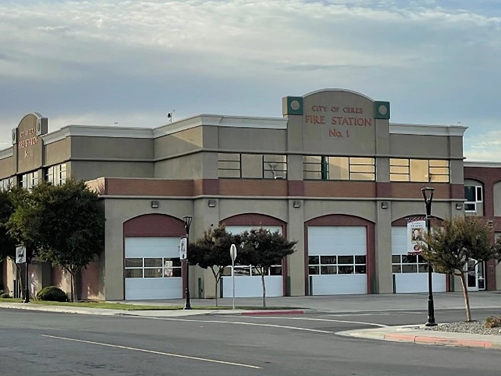
Wood Rodgers was hired by the City of Ceres to prepare a Specific Plan for a 535-acre land area near the southwestern edge of the City. Located along State Route 99 adjacent to urbanized areas in the City, the Plan Area is included in the City’s General Plan planning area and Sphere of Influence (SOI), and as such, is recognized as a logical growth extension for the City. The Copper Trails Specific Plan (CTSP) includes a comprehensive development plan, which establishes land uses, a circulation network, utility plans, parks and recreation facilities, public services, and implementation measures to guide development activity. It also includes a custom-tailored set of development standards and design guidelines to ensure that the project vision is upheld over time. At full buildout, the CTSP accommodates development of approximately 2,392 single- and multi-family dwelling units in densities ranging from 4 to 30 units per acre (du/ac), ultimately housing approximately 6,745 residents. In addition, the CTSP adds nearly 1.2-million square feet of retail and office uses and has the opportunity to create approximately 2,339 jobs. Adoption of the CTSP also included an annexation process with the Local Agency Formation Commission (LAFCO) to formally incorporate the Plan Area into the City’s corporate boundaries. The Ceres City Council is anticipated to consider project approval, including certification of an Environmental Impact Report, in December 2024.

This ongoing multi-year assignment involves planning and designing over $30 million in infrastructure improvements, with Wood Rodgers providing all civil and landscape architecture services. Working closely with UC Davis, the project is building on prior studies combined with fresh analysis to optimize the approximately $30 million in utility and site improvements to be installed over the next several years. The results of the effort include detailed alignments, sizing, and phasing requirements that address the overall building plan and the complexities of the work being done in the middle of a 24/7 facility.

Wood Rodgers partnered with Douglas County planning staff to complete the Douglas County 2020 Master Plan Update. The primary scope of work included reorganization of a master planning effort that was started in 2016, consolidation of goals and policies, and creating a plan that was easy for the public to understand and rich with graphical content. The scope of work also included innovative public outreach given the COVID pandemic restrictions. In a very short time frame our team provided the final plan, including public outreach, within a 5-month period. Our Team assisted with a joint planning commission and board of county commission workshop virtually, developed a community wide survey, and assisted with virtual presentations, as well as reservation only workshops. The initial work on the plan included an extensive goals and policy audit that ultimately lead to a complete overhaul of the goals and policies for the County.

Wood Rodgers provided geotechnical services for proposed improvements to the Edgewood Golf Course facility. Plans were being considered for the development of a new lodge, construction of several casitas, an expansion to the existing lodge, and construction of a parking garage. Critical considerations included high groundwater, estimation of seasonal high ground water, and liquefaction analyses.
Our geophysical capabilities (shear wave, and primary wave) allow us to generate unique insights as to the groundwater environment and excavation potential. Wood Rodgers working closely with TRPA to comply with the off season grading exemption requirements to allow us to perform exploration activities between October and May. Our geotechnical staff brought a unique capability to the estimation of seasonal high ground water due to their understanding of local and regional geologic and geotechnical concerns.

Wood Rodgers was responsible for the land planning and design services for the 1,678-acre, 5,375 dwelling units Fiddyment Farms project located within the West Roseville Specific Plan (originally approved in 2004). This currently developing residential community includes a mix of lot sizes and product types, commercial uses, and an extensive park and open space program designed to preserve significant stands of native oaks, creek corridors and wetlands. Wood Rodgers’ efforts include the processing of a number of Specific Plan Amendments in response to changing market conditions. Wood Rodgers was also responsible for processing the Tentative Subdivision Maps for the Fiddyment Ranch portion of the specific plan.

The Fiddyment Ranch Bike Trail Master Plan provided conceptual planning and Landscape Improvement Plans for approximately five miles of class one bike trail adjacent to Pleasant Grove Creek within the master planned community of Fiddyment Ranch in Roseville, California. The bike trail comprises nearly 20% of the City’s 27 miles of off street bike trails while serving as a major recreational component for the Fiddyment Ranch Community. Our team worked closely with the City of Roseville Bikeway Planning Department in developing the plan which serves as a link between the two neighboring communities of Creekview and West Park.
The Fiddyment Ranch Bike Trail Master Plan included three creek crossings, two street under crossings and considerations for connections into current and future neighborhood and regional parks. A major project goal was to provide gentle slopes in the trail avoiding the need for large grade cuts or retaining walls along the picturesque open space corridor. The plan was successful in balancing the needs of the community while meeting the strict requirements of working adjacent to a riparian zone.

Wood Rodgers is working on two separate muli-disciplinary teams preparing plans for two product types on four sites with varying muli-family product types: bungalows and apartments, each of which are very high density, making the value of outdoor open and amenity space that much more valuable. Each of the sites has a pool/spa/wading pool community recreaion space, in addition to courtyard areas between buildings that are furnished with barbeques, seating and shade structures. There are dog parks in addition to childrens’ play areas at the site in Roseville. In Folsom, special attention on was paid to the interface of the projects with permanent open space that has trails and wildlife interpretative signs, also designed by our firm as the master landscape architect for this planned community.

Over the course of two years and a race-to-the-end finish driven by an opening day and arriving residents, Wood Rodgers provided comprehensive entitlement, planning, engineering, and landscape architecture services for this memory care facility located in suburban Granite Bay, Placer County.
The roughly 4-acre site was gently sloping and studded with native oaks prior to development. Our landscape architects and civil engineers collaborated on a site design that shifted buildings and parking areas to accommodate many of the trees, while creating an emergent wetland that serves as a stormwater detention and infiltration mechanism.

Wood Rodgers provided the simultaneous design of two potable water pumping stations for the City of Napa. The Atlas Fire started north of the City and burned over 51,000 acres including two of the City’s potable water pump stations, the Hillcrest Pump Station and the Silverado Highlands Pump Station. The pump stations are both located on space constrained sites, necessitating an efficient layout of the pumping facilities and sites to provide adequate access for operations and maintenance activities. Both pump stations included a new building with an enclosure for the diesel powered emergency generator. The pump stations consist of skid mounted vertical multi-stage pumps capable of pumping up to 1,000 gpm to meet fire flow requirements. The hydraulic conditions and demands of each pump station are unique, therefore the Hillcrest Pump Station was designed with a total of three pumps, while the Silverado Highlands Pump Station has three main pumps and a small jockey pump to meet a wide range of hydraulic conditions.

Wood Rodgers' survey team performed terrestrial laser scanning at this mine's processing plant, which has proven to be instrumental in advancing engineering efforts to upgrade and optimize the facility. By harnessing the detailed and precise three-dimensional data acquired through laser scanning technology, the point cloud and BIM models provided engineers with valuable insights into the plant's current layout, identifying opportunities for improvement and areas requiring upgrades. This comprehensive dataset aids in the development of innovative solutions to enhance processing efficiency, streamline workflow, and address any structural or equipment concerns. Leveraging the information derived from the terrestrial laser scanning, our client can make informed decisions, ensuring that upgrades are strategically implemented to maximize operational performance, minimize downtime, and ultimately contribute to the sustainable and successful re-start of the gold mining operation.

Wood Rodgers partnered with the City of Sacramento and the Sacramento Housing and Redevelopment Agency on this project that was the culmination of a decade of redevelopment planning. Located on R Street, the Ice Blocks encompass three half blocks of new and rehabilitated building construction.
Ice Blocks 2 contained an apartment project with ground level retail, restaurants, and a second floor roof deck that houses a bar, water feature and series of outdoor rooms created by strategically placed planters and site furnishings. Ice Blocks 3 is a commercial property that uses masonry walls of a former agricultural supply company to establish an industrial chic aesthetic, complete with a courtyard that can be private or opened up on three sides for nearly complete transparency. A bocce court was constructed outside of a soon to open restaurant to further enliven the street scene and create an active streetside land use.
The project focused on low-water-use plantings, used gabion baskets for site furnishings, and reclaimed cobblestones from the adjacent street to accentuate the project’s gritty vernacular.

The project consisted of both a renovation and expansion of the previous International Arrivals Building at the Oakland International Airport. Landside duties included reconfiguration and rehabilitation of an employee parking and airport delivery area, relocation of the existing AOA fence and utility design associated with the new facility. Airside duties included the design of a reconfigured passenger boarding bridge, hydrant fueling modifications, pavement marking layout for revised aircraft parking areas, realignment of Taxilane S.Through preparing multiple alternatives, and discussion with the Port and stakeholders (UPS, Air Carriers, Swissport), we were able to meet each stakeholders needs with minimal impact to the project scope and budget.

Wood Rodgers, Inc. provided professional engineering and surveying services for 54-acre hillside project that includes 180 single-family residential lots with all private streets, a commercial parcel, and various common parcels for parks, open space, water quality and parking. Karrie is the Principal-In-Charge of the project and scope of services include the preparation of a mass grading plan, preparation of on-site improvement plans, soundwall plans, stormwater management plan/report, hydrology and hydraulic analysis, and oversite of the subdivision final map. The project is in the final approval process with Construction expected to begin in fall 2021.
Wood Rodgers, Inc. provided professional engineering and surveying services for Laurel Ranch, a 54-acre hillside project that includes 180 single-family residential lots with all private streets, a commercial parcel, and various common parcels for parks, open space, water quality, and parking. Located in the City of Antioch, the project is divided into two neighborhoods: the Wildwood Neighborhood made up of 88 homes and the Bayberry Neighborhood consisting of 92 homes. After Wood Rodgers prepared grading, stockpile, improvement, and plot plans, in addition to a final map, the site is well into its construction phase.

The City of Wheatland received notification from the California Department of Water Resources (DWR) regarding its eligibility for a grant under the DWR's Small Communities Flood Risk Reduction (SCFRR) Program. This grant was utilized to develop a Woodland Feasibility Study aimed at enhancing flood protection for the City and its surrounding community.
To assess potential flood risks, a comprehensive review of existing geotechnical levee investigations and analyses was conducted. This evaluation revealed deficiencies in cases where geotechnical data had been collected but not analyzed. Consequently, a thorough analysis of existing levees was performed, covering aspects such as geotechnical stability (including under seepage, through seepage, and rapid drawdown), erosion potential, freeboard, and geometry.
The results of these analyses were made accessible via the ArcGIS Server, and a dedicated Dashboard was designed to present the levee section deficiency data to the project team. This Dashboard streamlined access to the results, allowing the project team to efficiently retrieve the information using a standard web browser.
On behalf ofSAFCA, Wood Rodgers evaluated 15 alternatives for constructing a multi-benefitproject on Little Egbert Tract in Solano County,California. The purposeof the study was to identify a preferred land use combination considering regionalagricultural sustainability, ecosystem enhancement, and flood risk reduction.
Little EgbertTract is locatedwithin the lowerreach of the Yolo Bypass immediately north of the city of Rio Vista. High water in February and March of 2017 cameclose to overtopping the restricted-height levee and caused Deep Water ShipCanal barge traffic to cease. Historically, when the restricted height levee isovertopped (1986 and 1997), the result is significant damage to the lands of the tract as well as State Highway84. During the 1997 event, the restricted height levee breachedat seven locations, with breach widths ranging from 100 to 850 feet.Additionally, almost 10,000 feet of the restricted height levee sufferedslope and crown damage. Damagesfrom the 1997 flood event amounted to approximately $2 million for RD2084 and $5 million for Caltrans to repair State Route 84.
The work required coordination with a numberof regional stakeholders including Solano County,Caltrans, local Reclamation Districts, state, and federalfisheries agencies, DWR, and Westervelt Ecological Services. Wood Rodgers ledthe feasibility including providing project management, civil analyses,Feasibility Study report preparation, and facilitation of Study Charettes.
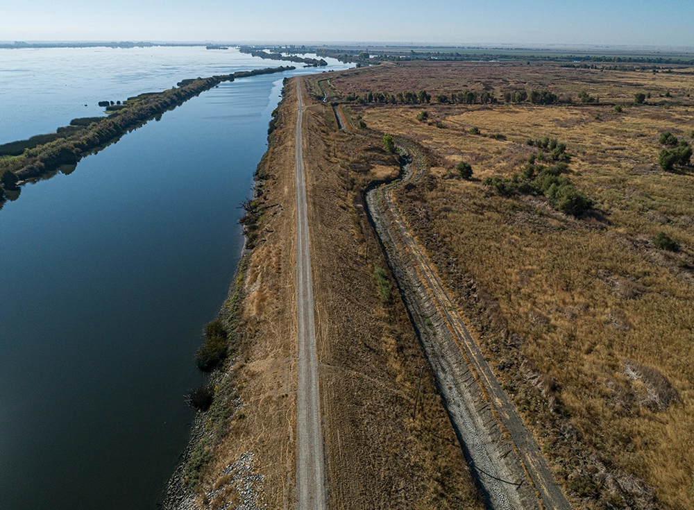
Wood Rodgers was the civil lead and Engineer of Record for the Lookout Slough Tidal Habitat Restoration and Flood Improvement Project, which is an innovative and groundbreaking initiative led by the California Department of Water Resources (DWR) in partnership with Ecosystem Investment Partners and Reclamation District 2098. The Lookout Slough project represents the single largest tidal habitat restoration project completed in the Sacramento-San Joaquin Delta to date, and it exemplifies DWR’s commitment to implementing projects that combine water supply, flood risk reduction, and environmental restoration benefits.
The Lookout Slough Tidal Habitat Restoration and Flood Improvement Project seamlessly integrates environmental restoration with innovative flood risk reduction measures. By restoring 3,000 acres of critical tidal wetland, the project re-defines large scale restoration. It not only revitalizes habitats for endangered species like the Delta Smelt but also strengthens the food web, supporting native fish and wildlife across the Delta. The Lookout Slough Project generates value for the community and environment by restoring critical ecosystems in the Sacramento-San Joaquin Delta, promoting biodiversity, reducing flood risk the region, incorporating adaptability for climate change, and incorporating recreation opportunities.
Beyond its ecological impact, the project advances a forward-thinking approach to flood risk reduction. By expanding the Yolo Bypass and creating 40,000 acre-feet of flood storage, the project reduces flood risks while bolstering the Central Valley Flood Protection Plan. The construction of a new setback levee, designed to withstand 100-year flood events with additional design height, showcases cutting-edge resilience to climate change and sea level rise—an engineering feat that goes beyond traditional flood protection measures.
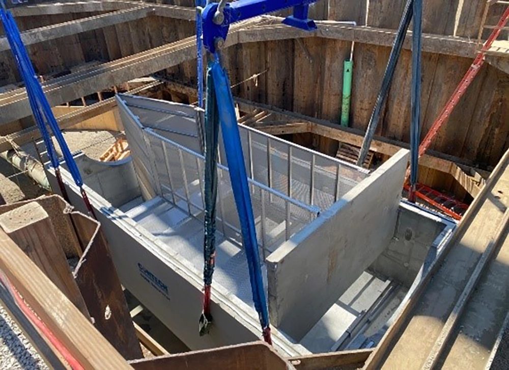
Wood Rodgers provided design services for a large trash capture device within Mandela Parkway and 24th Street by performing utility locating, site survey, hydrologic & hydraulic modeling, geotechnical investigation, design package development and construction support. The project involved the installation of the Contech DSBB and a 96-inch RCP piping diversion system for 600 acres of catchment. The project was designed to minimize hydraulic head loss and capture trash for compliance with Regional Board regulations. The project required deep construction, substantial summer flow bypass, shallow groundwater dewatering, a safe traffic control plan, and accommodation to minimize business interruption.

Wood Rodgers assisted the City of Rancho Cordova with preparation of an Active Transportation Program (ATP) Grant application for this project. The grant was awarded and the City secured $2.2 million for the design and construction of 8,400 linear feet of Class 1 pedestrian and bicycle trail. We provided public outreach efforts and are preparing the PS&E for the project. The project will convert an unused rail corridor to an ADA compliant Class 1 trail that will provide connectivity between a light rail station, the Veterans Administration Hospital, Mather Commerce Center airport, and other commercial and institutional destinations.
The project includes trail monument signs, seating nodes with custom shade structures, landscaping, striping and signage, lighting, a pedestrian traffic signal, ADA curb ramps and traffic signal modification, as well as utility coordination and modifications. Wood Rodgers developed alternatives to construct the trail without removing the tracks from the underpass and is preparing final construction documents for the preferred solution, which will also include upgraded pedestrian fencing, storm-water drainage conveyance, and trail lighting on the structure.
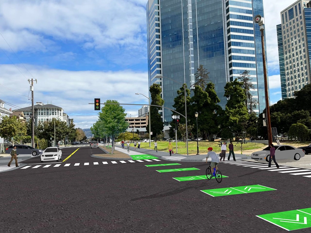
Wood Rodgers is developing Plans, Specifications, and Estimates for the Martin Luther King Jr. Way Streetscape Improvement Project in Oakland. The project aims to enhance safety and connectivity for pedestrians, cyclists, and drivers between 2nd Street and 14th Street. Key improvements include a buffered Class IV Cycle Track, upgraded traffic signals, new protected left-turn phasing, and pedestrian countdown signals. Sidewalks will be widened and made ADA compliant, curb ramps installed at intersections, bulb-outs where possible, new trees planted, street lighting throughout the corridor, and fiber installation from Embarcadero West to 7th Street. The Class IV Cycle Track will bridge a network gap, providing a safe connection to funded bikeways. Upgraded signals will meet current standards, with ADA compliant features and leading pedestrian intervals. Curb ramps and bulb-outs enhance pedestrian safety, especially for those with disabilities. High-visibility crosswalk markings and pedestrian-scale lighting will be implemented at intersections, improving visibility under I-880. The project also includes utility relocations, with specific details identified during the final design phase and coordinated with service providers to minimize disruptions.

Wood Rodgers, Inc. provided structural design and construction support services for this 3-story, Class A, office building. Wood Rodgers Structures designed all aspects of this building from the pier foundation to the roof beams. The building includes concrete tilt-up walls with an interior structural steel frame and concrete-filled metal deck floor system, supported on cast-in place piles. Features included an entry canopy and a large architectural curved window wall, that was also designed by Wood Rodgers Structures. The building was modeled with 3D structural analysis software providing a complete analysis design of all the gravity and lateral members. Analysis results were then exported into Revit BIM software to create the final design documents. Wood Rodgers was able to support the architect’s aesthetic vison while also achieving a high standard of safety through this project.
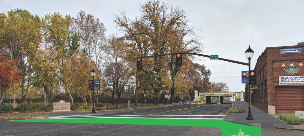
Wood Rodgers provided professional services to develop a streetscape plan, 30% preliminary engineering, and obtain the necessary approvals for the California Environmental Quality Act (CEQA) and the National Environmental Policy Act (NEPA) review and documentation. The North 16th Street Streetscape Project included concept development, public outreach, environmental documentation, and preliminary engineering for street-grade pedestrian improvements on 16th/North 16th Street between Richards Boulevard and H Street through the River District, Washington School Historic District and Mansion Flats within the Central City of Sacramento.
The project improvements addressed pedestrian and vehicular lighting, bike route connectivity, sidewalk widths, LID flow-through, stormwater planters and drainage improvements, ADA compliance, signage and crosswalks, on-street parking, and accessibility, aesthetic, and security treatments to the Union Pacific Railroad (UPRR) pedestrian tunnel.
The proposed improvements were vetted through a community outreach process that initially coordinated with River District planning efforts and culminated with an open house specific to 16th Street. The project is pending approval by the Sacramento City Council.
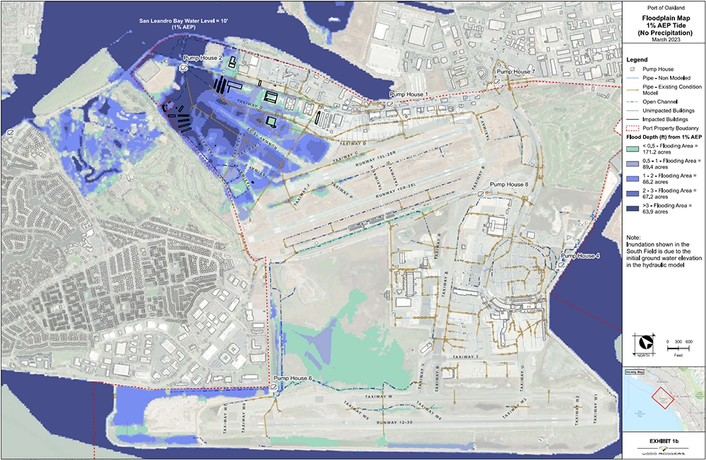
Wood Rodgers developed an update of the Oakland International Airport (Airport) Stormwater Management Implementation Plan (prepared in 2009), assessed the vulnerability of the North Field to tidal flooding (including sea level rise and seismic vulnerability of existing embankments) and identified improvements to mitigate or prevent flooding at the North Field of the Airport. The approximately $1M project consists of two major components:
1 | Updating the Airport Stormwater Management Implementation Plan
Wood Rodgers updated the Airport’s existing stormwater management model (XPSWMM and Tuflow). This project included performing a condition assessment of existing infrastructure under the challenging conditions of working on an active airfield and following FAA regulations. Wood Rodgers developed custom GIS software for the collection and processing of field inspection data. Wood Rodgers also provided a robust Operations and Maintenance Plan and developed capital improvement plan recommendations.
2 | Assessing Tidal Flooding Vulnerability at the North Field
Wood Rodgers assessed the tidal flooding vulnerabilities at the North Field of the Airport and recommend improvement to mitigate predicted flooding. This involved examining current tidal flooding threats and future tidal flooding threats with sea level rise. Wood Rodgers developed a dynamic tidal floodplain analysis of the North Field using advanced hydraulic modeling to determine the actual flooding potential, considering the transient nature of tides. Wood Rodgers reviewed FEMA’s Flood Insurance Rate Maps (FIRM) for the Airport and developed 2D models of tidal flooding, assessed the existing condition of tidal flood protection facilities at the North Field, in order to identify a range of options and recommendations for improvements to remove the flood hazard for the North Field of the Airport. The tidal flooding vulnerability assessment includes an adaptive mitigation plan for phased shoreline protection, providing the Port with a risk-based approach and a decision framework for implementing flood improvements. The improvements account for the potential for sea level rise over the course of 50 years. Wood Rodgers prepared conceptual designs (10% design) of the Airport’s preferred tidal flooding protection improvements. The conceptual designs addressed standards for static stability, seepage, storm surge, wave runup, 100-year storm event, and any other criteria necessary to remove FEMA’s flood hazard area designation from the North Field. The conceptual design also addressed seismic performance and sea level rise. Wood Rodgers created schedules and cost estimates for the proposed improvements.

Wood Rodgers provided a full range of planning and engineering services for this 577-acre, mixed-use community located at the crossroads of Interstate 5 and State Route 99 in the City of Sacramento. Northlake is one of the most innovative efforts in the region to integrate traditional neighborhood design principles with transit-oriented development. At buildout, the project can accommodate development of approximately 3,500 residential units with a variety of housing types to support all market segments. One of the community’s central features is its planned light rail transit station, which is centrally-located alongside a mix of retail, office, and housing to support transit ridership.

Wood Rodgers provided landscape architecture and civil engineering services for this roughly 3-acre site which serves as a focal point within the Northlake community. The site features indoor and outdoor covered activity spaces, a pool, spa and lakeside overlook, as well as group and individual pavilions located poolside.
Over the course of more than a decade, Wood Rodgers provided land planning, entitlement, design and construction services for many phases of this 700+-acre master planned community, which was awarded that North State Building Industry Association’s 2024 Master Planned Community of the Year award. Establishing a design theme in concert with the development team, services have included the preparation and processing of all street, lake walk promenade, open space and park landscaping plans, each of which execute a contemporary, ‘modern agrarian’ theme.
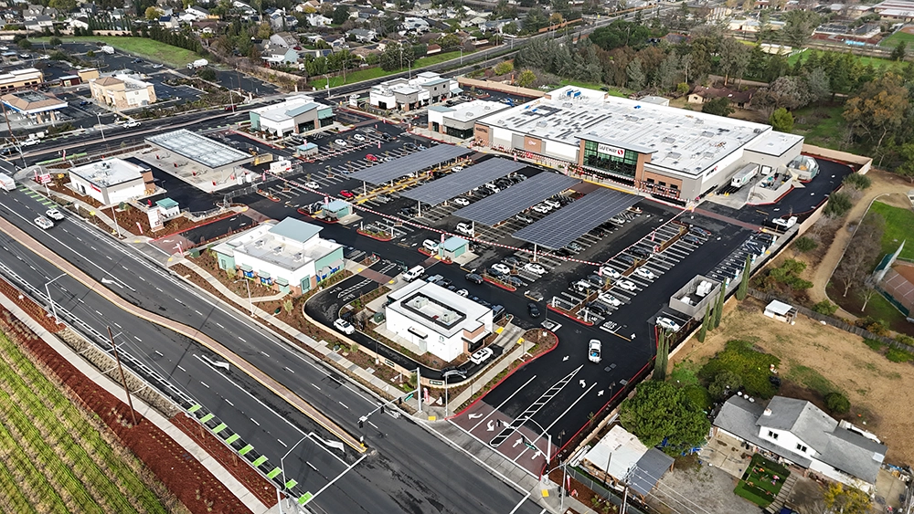
Wood Rodgers Structures prepared structural calculations, structural drawings and specifications for the retail shopping center. The retail shopping center contained one large retail anchor tenant, Safeway, four smaller separate shops/pad buildings, and associated site work located in Oakley California. The Safeway building consists of a main roof framed with metal deck supported by steel roof joist/girders bearing on interior isolated steel columns and CMU walls at the exterior. The main entrance tower was framed primarily using metal stud construction and structural steel. The smaller buildings consist of primarily wood framed stud walls, panelized wood roof structure, and supporting interior steel columns. The exterior wood bearing walls also were wood shear walls for the building lateral force support system.
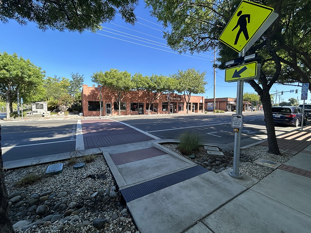
Wood Rodgers was recently awarded this three-year, on-call contract for the Town of Loomis. Typical projects could include roadway, streetscape, landscaping, drainage and structures project, or other Public Works construction projects. The projects will require a full service consultant with the ability to deliver a wide range of services including, but not limited to: topographic surveys, boundary survey, ALTA/ ACSM Land Title Survey, preparation of legal descriptions and exhibit plats, construction staking, settlement monitoring, utility surveys, FEMA elevation certifications, aerial photography, aerial mapping, transportation, preparation of plans specification and estimates for projects including, but not limited to; sidewalk, storm drain, new roads, overlay of existing roadways, cape seal, striping, etc. The Town performs numerous construction projects each year. Most of the projects qualify for categorical exemptions under the California Environmental Quality Act (CEQA) and for IS/MND under the National Environmental Policy Act (NEPA). Some of the projects require environmentally related permits. The projects will require the ability to deliver a wide range of services including, but not limited to: investigating proposed construction sites, determining if there are any potentially significant environmental impacts, preparing CEQA/NEPA documents and obtaining necessary permits for one or more projects.

Wood Rodgers led the civil design and permitting of this ~150,000 square-foot industrial warehouse project. The Wood Rodgers team coordinated closely with the owner, the contractor, architect, and entitlement lead throughout the entire project.
Our approach resulted in an approved drainage study, traffic mitigation letter, and conditional approvals from the utility providers by the time the project received entitlement approvals from Clark County. Additionally, Wood Rodgers’ urgency to prepare preliminary drainage and grading design concurrent with the entitlement project allowed all design related items to be considered as part of the initial entitlement process as opposed to addressing drainage and grading related items separately during design, shaving months off of the permitting timeline. This approach enabled the civil design plans to be submitted to CCPW upon issuance of the NOFA, thereby reducing project delays.
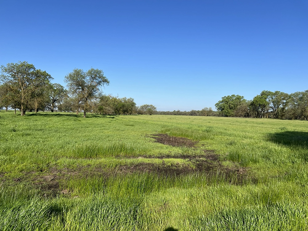
In March 2024, Wood Rodgers was awarded a contract for Engineering Design and Environmental Services for the Pleasant Grove Stormwater Retention Basin Project. The project involves the construction of two large retention basins, which due to their size are jurisdictional dams in accordance with Department of Water Resources Division of Safety of Dams. The contract covers site reconnaissance, field investigation and laboratory testing, alternatives analysis, design documentation, environmental permitting and regulation support, CEQA compliance and documentation, biological research studies, PS&E preparation (35% through Final bid package) and bid support. Currently we are 7 months into the 24-month project schedule and have completed the Phase 1 investigation consisting of 42 borings to depths of between 60 and 100 feet. Laboratory testing to provide geotechnical parameters for slope stability and seepage analysis are ongoing. Details of the field investigation and laboratory testing results will be documented in a Geotechnical Data Report. This information will be used to categorize the site and perform geotechnical analysis for design. The project involves several structures including spillways and creek crossings, the detailed design of which will be completed in-house with coordination with our civil and structural teams during design development. This project illustrates our ability to harness the collective technical abilities of Wood Rodgers to perform complex designs for large-scale projects.
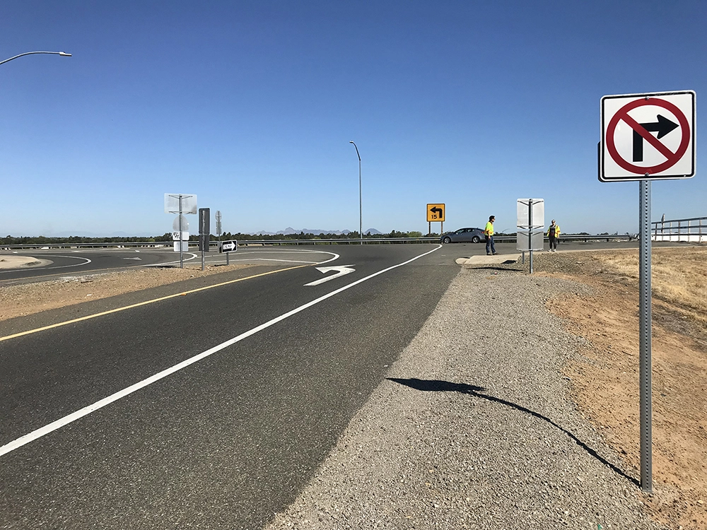
Wood Rodgers, led by Jason Lemons and Dylan Tran are delivering the final design for this Interchange improvement project. Our team recently submitted 65% PS&E and are on pace for Ready to List in late 2025. The Wood Rodgers team was selected by Yuba County to take over final design from another consultant. The project is constructing a new onramp, modifying existing ramps and extending Plumas Lake Blvd to the east over UPRR and an Army Corps of Engineers (USACE) levy system. Tasks include preparing construction plans; specifications and estimate including roadway design; drainage design; bridge design; trail design; and traffic signal design. Wood Rodgers is coordinating with utilities for major relocations; preparing CEQA and NEPA re-evaluations; obtaining permits and approvals, including approvals and agreements with Caltrans, USACE Section 408 and 404 permits, CDFW 1602 Permit; preparing traffic analyses; obtaining needed right of way; obtaining railroad and CPUC approvals; and delivering a project that meets Caltrans and Federal requirements. Wood Rodgers will subsequently provide bidding and construction assistance through to project completion. Monument is responsible for the R/W acquisition on this project. On January 7, 2025 Yuba County was awarded a $35.5 million RURAL Grant based on the support of Wood Rodgers. The Wood Rodgers team was able to develop design enhancements that reduced the cost of this project by $13 million (over 30%)

Wood Rodgers spearheaded a $1M project aimed at updating and fortifying the Oakland International Airport's (Airport) Stormwater Management Implementation Plan, originally crafted in 2009. The multifaceted initiative comprised two pivotal components:
The tidal flooding vulnerability assessment delivered an adaptive mitigation plan, outlining phased shoreline protection to mitigate risks over 50 years. Conceptual designs (10% design) of preferred tidal flooding protection improvements met stringent criteria, including static stability, seepage, storm surge, wave runup, and seismic performance. Wood Rodgers furnished schedules and cost estimates for these proposed improvements, aiming to eliminate FEMA's flood hazard designation from the North Field and ensure the Airport's resilience against future challenges.

Wood Rodgers took on the analysis, design, and construction support for a substantial trash capture device project within the Port of Oakland. This comprehensive endeavor encompassed utility investigations, site optimization, surveys, hydraulic analysis, basis of design report, design package development, and construction support. A study was initiated to assess the optimal location, configuration, and types of full trash capture devices for the watershed. Wood Rodgers aimed for designs that were not only hydraulically optimized but also easily constructable and maintainable.
Addressing challenges, the original proposed site posed significant wetland impacts, prompting Wood Rodgers to collaborate closely with the Port. Leveraging our knowledge of the Port’s storm drain system, we successfully relocated the site, eliminating wetland impacts and enhancing trash collection efficiency while minimizing backwater effects.
Further challenges were met with innovative solutions. Wood Rodgers employed post-construction large trash capture performance knowledge and detailed modeling to optimize the design, reducing head losses and mitigating impacts on the upstream storm drain system. Recognizing potential excessive maintenance requirements, we conducted thorough interviews, designed improvements for vector control, sediment channelization, and ease of maintenance, culminating in an access platform for maintenance and vehicular access.
In summary, Wood Rodgers not only overcame challenges but also ensured a holistic and efficient approach to trash capture device design, emphasizing optimization, environmental impact reduction, and long-term maintenance considerations.

Rancharrah, a 140-acre ranch in the thriving suburban area of south Reno, holds historical significance as the former residence of Bill Harrah, founder of Harrah’s Hotel/Casino. Wood Rodgers undertook the development of a master plan, envisioning a mixed-use community that harmonizes with the surrounding neighborhoods. Preserving the ranch's core as a special events and equestrian center was paramount. The residential aspect encompasses a diverse mix, including custom and semi-custom homes, condos, and assisted living complexes. The commercial facet, aptly named The Village, spans 16.6-acres and boasts over 125,000 square feet of office, retail, restaurant, spa, medical, and financial institution spaces.

Wood Rodgers services included environmental technical studies, CEQA and NEPA documentation, regulatory permitting, compensatory mitigation coordination, restoration plans, and construction monitoring and support for the RD 1001 Auxiliary Drainage Pump Station Project. The project will construct an auxiliary pump station to serve as supplemental pumping capacity and will help to minimize flooding in the event of an electrical outage at the District’s Main Pumping Plant.
Technical analysis included biological and cultural studies supporting determinations of the project’s CEQA Initial Study/Mitigated Negative Declaration, and NEPA Categorical Exclusion. Wood Rodgers provided extensive support for NEPA compliance through the FEMA Hazard Mitigation Grant Program, including Section 106 Consultation with SHPO, and Section 7 Endangered Species Act consultation for Giant Garter Snake and anadromous fish. Additional permits secured by the team included, U.S. Army Corps of Engineers 404 and 408 permits, 401 Water Quality Certification, CDFW Streambed Alteration Agreement and Incidental Take Permit, and a floodplain encroachment permit from the Central Valley Flood Protection Board.
Project construction is anticipated in 2024. Wood Rodgers will provide full service environmental construction support, including special status species surveys and monitoring, environmental commitments compliance, and implementation of the habitat restoration plan.

RED is a 40-acre redevelopment mixed-use project in the heart of Reno, offering nearly 1,000 apartment units, a 170-key hotel, a 2 acre park, and approximately 65,000 sf of retail/restaurant space. Wood Rodgers’ role in development of RED has been a true multi-disciplinary effort. It started with Planning services during the concept stage which transitioned to Mapping Actions, Geotechnical Investigations, and Civil & Structural Design. These led to construction services including Testing and Inspection as well as Survey Staking.

Wood Rodgers was responsible for complete airfield engineering design and construction administration assistance for this Runway Reconstruction Project along with the majority of its connecting taxiways. This project included paving work, electrical upgrades, and correcting taxiway geometry for three separate taxiways, a portion of the parallel taxiway, as well as full reconstruction of the primary runway.

Wood Rodgers provided comprehensive civil engineering, land planning, and surveying and mapping services for this 3,800-acre master planned community. The development consists of 11,600 residential units, 520-acres of commercial development and 1,400-acres of public and quasi-public land uses. Wood Rodgers prepared the engineering master plans for infrastructure to serve the development area as well as improvements to existing facilities including transportation (roadways, transit, bike ways and pedestrian trails), sanitary sewer, water supply, storm water/drainage and water quality. Current efforts include preparation of mass grading and improvement plans along with large and small lot final maps.
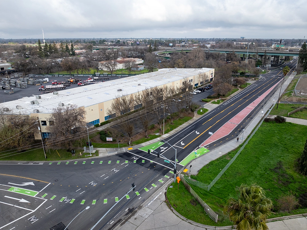
Wood Rodgers prepared Plans, Specifications, and Estimates for a quarter-mile extension of Riverfront Street and widening of 5th Street from two lanes to its ultimate width between 15th Street and Mill Street for the City of West Sacramento. The project also required reconstructing the eastbound US 50 on-ramp at Fifth Street due to grade changes along Fifth Street, and modifications to two existing traffic signals at 15th Street and Bridge Street. To complete a bicycle connection between the existing bike lanes on 15th Street and the River Walk Trail, the project will construct a Class 4 Cycle Track along Fifth Street as an interim condition until the River Walk Trail is extended in the future, and new curb, gutter, and sidewalk for pedestrians, extending improvements of the Bridge District Specific Plan. Retaining walls were included. Services included preparing supplemental CEQA and NEPA environmental documentation, geotechnical analysis, permitting and right-of-way services. Wood Rodgers also developed design for sewer and water facilities, as well as developing an innovative underground storage and infiltration storm drainage system. The Project included coordinating with PG&E, AT&T, Wave, and Consolidated Communications to develop 2,000 feet of joint trench for electrical, telecommunication, cable tv, street lighting, and ITS for current and future development. The project is also undergrounding 800 feet of overhead telecommunication facilities. Wood Rodgers was responsible for preparing all Caltrans Local Assistance Procedures Manual forms for the City and worked with Caltrans Local Assistance to obtain the E-76 and Caltrans Encroachment Permit.

The largest surveying contract in the Reno office, Wood Rodgers was retained to provide numerous surveying activities for this on-call contract. For over 30 months Wood Rodgers had a survey crew permanently based at the site supporting ongoing construction. These activities include as-built surveys on excavation and finished grade pads. Construction layout and QA surveys on slabs and footings for buildings, crushers, and conveyors. Regularly scheduled and as requested volume surveys performed with both ground and aerial survey methods. Quarterly aerial surveys for environmental monitoring and disturbance reports

The Wood Rodgers, Inc. environmental team is providing professional services including NEPA documentation and environmental technical analysis for a transit and safety improvement project along the Virginia Street corridor in the City of Reno, Nevada. Improvements, consisting of roadway reconfiguration for a new bus-only lane, utility modifications, new street lighting, and the installation of ADA-compliant facilities at eight existing transit stations, are intended to enhance connectivity and safety along the Virginia Street corridor and improve accessibility to transit in the area.
Wood Rodgers has prepared a Federal Transit Administration (FTA) NEPA Categorical Exclusion Checklist through coordination with the FTA, the Regional Transportation Commission of Washoe County (RTC), and the Project Management Oversight Contractor (PMOC). Supporting the NEPA CE are several environmental technical studies including a cultural resources report documenting historic buildings in downtown Reno adjacent to Virginia Street, and Phase I Hazardous Waste Initial Site Assessment (ISA) Construction is anticipated to begin in late 2024 to 2025.

On behalf of the Sacramento Area Flood Control Agency (SAFCA), Wood Rodgers evaluated 15 alternatives for constructing a multi-benefit project on Little Egbert Tract in Solano County, Ca. The purpose of the study was to identify a preferred land use combination considering regional agricultural sustainability, ecosystem enhancement, and flood risk reduction.
Little Egbert Tract is located within the lower reach of the Yolo Bypass immediately north of the city of Rio Vista. High water in February and March of 2017 came close to overtopping the restricted-height levee and caused Deep Water Ship Canal barge traffic to cease. Historically, when the restricted height levee is overtopped (1986 and 1997), the result is significant damage to the lands of the tract as well as State Highway 84. During the 1997 event, the restricted height levee breached at seven locations, with breach widths ranging from 100 to 850 feet. Additionally, almost 10,000 feet of the restricted height levee suffered slope and crown damage. Damages from the 1997 flood event amounted to approximately $2 million for RD 2084 and $5 million for Caltrans to repair State Route 84.
The work required coordination with a number of regional stakeholders including Solano County, Caltrans, local Reclamation Districts, state and federal fisheries agencies, DWR, and Westervelt Ecological Services. Wood Rodgers led the feasibility including providing project management, civil analyses, Feasibility Study report preparation, and facilitation of Study Charet

Wood Rodgers provided design and construction assistance services for this multi-use detention basin and park project in South Sacramento, California. Wood Rodgers performed hydraulic analysis to determine the size of the basin necessary to provide, when combined with the USACE Florin Creek Channel Improvement Project (a Wood Rodgers and MGE Engineering Joint Venture design), 100-year flood protection for residents adjacent to Florin Creek. The project included: civil, hydraulic, mechanical, and structural elements to design the flood control components of the facility as well as Americans with Disabilities Act (ADA) compliance analysis, sports field design, and landscaping design to enhance the recreational functionality of the community park.

Wood Rodgers was part of Design-Build team selected by Solano Community College District to prepare design development and working drawings for their Vallejo Campus Auto Technology Building located in the hills east of interstate 80 corridor off Columbus Parkway. The project included a 34,000 sf start-of-the-art automotive technology building and approximately 3.5 acres of site development/reconstruction in the vicinity of the building, plus improvements to existing landscape.

Wood Rodgers, Inc. provided surveying, planning, and engineering services for the redevelopment of an existing school site into 54 single-family residential lots on 9 acres of land. Planning services included a Vesting Tentative Subdivision Map, General Plan Amendment, and Rezone. Wood Rodgers was responsible for public street geometric and vertical design, utilities, grading, and storm water treatment design. With a mix of market rate and affordable homes, the subdivision blends seamlessly with the adjacent neighborhoods.
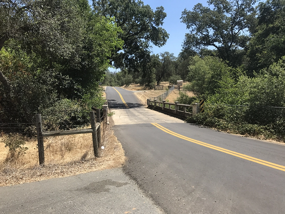
The Wood Rodgers bridge group was selected by Yuba County Department of Public Works to provide bridge and roadway design services for the Spring Valley Road Bridge Replacement Project. The project is being funded by the Caltrans federal-aid Highway Bridge Program (HBP) and State Toll Credit Program. The existing Spring Valley Road Bridge (Br. No. 16C0091) over Little Dry Creek was constructed in 1920 and is a four-span continuous reinforced concrete slab bridge with concrete abutment and bents founded upon spread footings. The bridge is approximately 61 feet long and 20 feet wide. The Sufficiency Rating is 55.5, and it is "functionally obsolete." The replacement bridge (Br. No. 16C0111) is a single-span100-foot-long by 36-foot-wide precast prestressed concrete wide flange girder bridge. The precast concrete girder bridge alternative eliminates falsework and environmental disturbance to the channel that would otherwise be needed for a cast-in-place concrete bridge alternative. The new alignment shifts the creek crossing 50 feet south and replaces the existing reversing "S" horizontal curve with a single horizontal curve. The improved geometrics allow the design speed to increase from 27 mph to 40 mph, stopping sight distance to increase from 175 ft to 305 ft, and standard superelevation transitions and runoffs incorporated. The western and eastern roadway approach lengths are approximately 400 feet, which complies with the Highway Bridge Program (HBP) approach length limit for funding on non-federal aid roadways. The project includes realignment and reconnection of three private driveways at three-corners of the bridge and 70-foot long by 16-foot tall, reinforced concrete, cantilever retaining wall. Project tasks include geotechnical sampling and reporting, engineering structural analyses using AASHTO LRFD and Caltrans SDC design methodologies; geometric design using AASHTO Policy on Geometric Design of Highways and Streets and Roadside Design Guide and FHWA MUTCD; and drainage improvements, including underdrains, ditches, and dikes. The project was considered CEQA-IS/MND and NEPA-CE. Environmental permitting is currently being completed by the County’s environmental consultant and is expected to include the typical requirements for a natural watercourse (USACE CWA 404 NWP-14, RWQCB 401 WQC, and CDFW 1602 LSAA). Project team coordination has been continual for APE/cultural impacts, jurisdictional waters impacts, and permitting requirements. Project development and delivery have been coordinated with Caltrans District 3 Local Assistance consistent with the LAPG HBP requirements and LAPM programming, authorizations, and approvals. Monthly invoicing provides progress reports and % progress/spent on individual tasks.
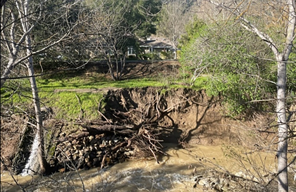
In April 2024, Wood Rodgers was awarded a contract for Engineering Design and Environmental Services for Phase 1- Repairs of Storm Damages to Flood Protection Facilities by Zone 7 Water Agency. This contract covered site reconnaissance, topographic survey, field investigation, laboratory testing, hydraulic analysis, alternatives analysis, design documentation, environmental permitting and regulation support, CEQA compliance and documentation, biological research studies, PS&E preparation (35% through Final bid package) and bid support. This project addresses storm damage (erosion and landslides) and creek repairs along creeks and channels impacted by 2023 storm events, with an emphasis on environmentally sensitive and structurally resilient solutions. A total of 50 sites were investigated and analyzed in preparation of design alternatives. Given the number of sites and range in size and type of failure, five repair alternatives were developed for design. For the large failure sites along natural creeks with no room for laying back the slope to a stable angle, a timber crib-wall design with willow pole plantings was used to provide an environmentally sustainable solution to buttress the slope and provide long-term stability. In addition to the timber buttress, four other typical repair types were developed to address site-specific challenges. These repairs prioritized natural finishes integrated with different material types (soil, rip-rap and soil filled rip-rap) to address the range of flow regimes and associated shear stresses at different repair sites. Wood Rodgers has successfully submitted the 100% design package, meeting all project milestones to date and have been retained to provide engineering services during construction.
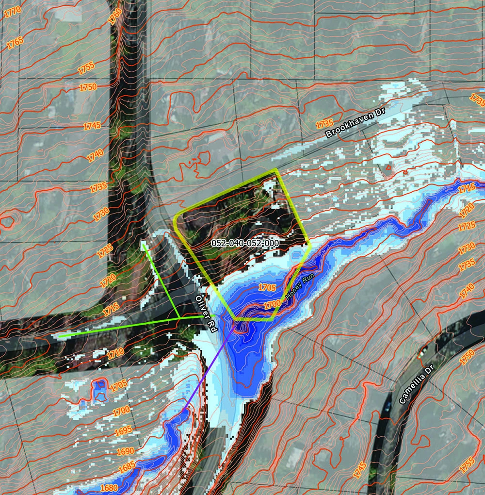
Wood Rodgers collaborated with the Town of Paradise, California to develop a comprehensive Storm Drain Master Plan (SDMP) to address the challenges faced after the devastating 2018 Camp Fire. The SDMP aimed to re-establish the storm drain infrastructure, reduce the risk of flooding, and guide the town’s reconstruction efforts. Leveraging Esri technology and the ArcGIS platform, Wood Rodgers utilized GIS processes to analyze data, identify deficiencies, and develop cost-effective solutions. The storm drain master plan developed by Wood Rodgers and the town Town of Paradise has had significant positive impacts. The town can now support the rebuilding process for individual home builders by providing flood information and guidance on where and how to build. Wood Rodgers generated parcel maps showing flood extents for all 11,000 parcels in the town, helping residents make informed decisions about rebuilding. The plan has provided a roadmap for infrastructure improvements, ensuring the town is better prepared for future flooding events. The successful collaboration effort between Wood Rodgers and the Town of Paradise has been recognized for its excellence. Wood Rodgers received the Commendation Engineering Excellence Award from the American Society of Civil Engineers (ASCE) for this project in 2023.
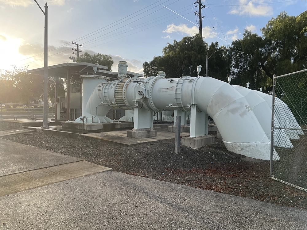
Wood Rodgers was awarded this $2,000,000 contract by the City of San Jose to refine and further develop the Citywide Storm Sewer Master Plan. The project included developing a comprehensive asset-based hydrologic and hydraulic GIS geodatabase, developing GIS tools, performing facility inspections, taking inventory of stormwater and green infrastructure facilities, and developing detailed hydrologic and hydraulic models for 400 miles of storm drains, 82 miles of open channels of the SCVWD facilities, 30 pump stations, and 6 reservoirs. The project also included refining a design storm based on historical gage data; surface and groundwater calibration based on 70 storm drain and stream gages; alternative improvement analysis; and a capital improvement plan. One of the tasks was developing detailed one- and two-dimensional large trash capture models and analyses for 30 sites to assess the impacts of the devices in pre- and post-project conditions. Wood Rodgers developed high water mark collection protocols for the sites with no flow gage data, coordinated high water mark collection, and analyzed and calibrated hydraulic models with high water marks and flow gage data. The sites found with significant hydraulic impacts were further analyzed to propose improvements to mitigate the deficiency.
Wood Rodgers revised and calibrated the citywide model for both the storm drainage and open channel systems to a network of flow gages distributed throughout City. Approximately 100 gages, including stream gages, pipe flow gages, and pump station wet well SCADA, were used in the calibration to determine the system performance and operations. Wood Rodgers used the refined, calibrated, and validated model to recommend a prioritized CIP for the City through a detailed Storm Sewer Master Plan report. Wood Rodgers also worked with the City Capital Improvement Group to optimize designs, analyze constructability, and recommend pump station operation improvements. The detailed and calibrated models have been used to support emergency action plan development, develop pump station operation manuals, and analyze the hydraulic impacts of large trash capture devices and other green infrastructure.
Wood Rodgers modeled and analyzed 30 large trash capture devices, 200 low impact development facilities, 10 hydromodification facilities, and large regional stormwater capture facilities to assess the hydraulic impacts for further improvement refinement. Capacity deficiencies were defined based on flood risks, and the improvements were prioritized based on cost effectiveness, permitting requirements, and multi-benefit objectives. Wood Rodgers has saved the City more than $20M by optimizing one of the improvements recommended in the previous drainage master plan developed by others.

This project consisted of 1.5-miles of improvements to Sullivan Lane, McCarran Boulevard, and El Rancho Drive. Improvements included roadway widening for the addition of bike lanes and sidewalk to meet the multimodal needs of the community and new Proctor Hug High School. In addition, three separate roundabouts, correction of localized drainage deficiencies, utility coordination and relocation, RTC bus stop replacement, retaining walls, full signal modification (Sullivan/McCarran), and a new overhead school zone flasher were included with this project.

Wood Rodgers provided full park Master Plan, design and construction documentation services for this turnkey, 6-acre Neighborhood Park, which is now maintained by the City of Sacramento.
Swainson’s Hawk Park was designed as a central gathering place for the 2,300 residential unit Natomas Central Community. One major design challenge was to provide adequate buffering between the site and adjacent homes while providing a combination of active and passive uses within the park.
As a solution, our team creatively implemented a network of landscape berms which allowed the park to include a diverse group of program amenities. The final design included a 7,500 sf playground with custom pedestrian bridge, informal skate board area, large group picnic structure, trellis, art in public places, bocce and horseshoe courts, and class 1 trail connections.

The Tahoe Reno Industrial Center is one of the world’s largest industrial parks and is home to some of the most advanced data centers. Wood Rodgers has provided geotechnical engineering, quality control, and materials testing services for several industrial parks in this area. Excavatability is a major concern in this region; we utilize on-site observation, geophysical testing, excavators, dozers, and geotechnical and blasting drill rigs to identify reasonable excavatability characteristics to aid the earth work contractor in refining their bid. Wood Rodgers has provided electrical resistivity surveys for use in development of substations or switchyards at many of the industrial parks in the area.

Wood Rodgers led the planning and design of this 3,900-unit development on 980-acres located along the western side of the newly constructed Veterans Parkway in Southeast Reno. The project included developing a Planning Unit Development Handbook that addressed a master plan under the new Reimagine Reno land use designations to include a mix of residential densities to promote housing options for the “missing middle”, as well as designing a town center surrounded by higher density. Wood Rodgers worked with the developers to design a community built around an extensive shared use path network connecting residential villages to open space, recreation opportunities, schools, and the town center/community gathering space. The Planned Unit Development also includes wetland mitigation, the restoration of Thomas Creek, and the creation of additional flood pool storage for the region.

Wood Rodgers provided professional engineering services for the design, management, coordination, and preparation of documents associated with the reconstruction of Taxiway M in its entirety, Reconstruction of Taxiway B within the RSA limits of Runway 7-25 and then the construction of two separate General Aviation Runup areas off of Taxiway C, one north of Taxiway A and another south of Runway 7-25.Working with the Airport Authority, Air Traffic Control Tower, and the design team, we developed a series of design considerations to keep the project within budget and allow the project to proceed without the airport having to build a new facility not meeting their needs.

The Ersted (Tennyson) Development involved rezoning and subdividing a 17-acre hillside site into 59 single-family townhomes, associated private streets and driveways, landscaped areas, and group open space areas for residents. The site is located on the south side of the Tennyson Road extension east of Mission Blvd in the city of Hayward, California. Wood Rodgers provided a plethora of civil engineering, land planning, surveying, and mapping services throughout the lifetime of the project.

Located on a prominent 16-acre infill site, Arden Gateway occupies a former hotel site adjacent to a regional mall. Constructed in two phases, the site provides a segue between the mall and its land use to an existing multi-family neighborhood to the north.
Lifestyle oriented amenities abound in each phase of the project: intimate courtyards at building entries, two pool areas, each with its own complement of outdoor spaces including fireplaces, outdoor kitchens, a yoga lawn and outside game zones encourage the formation of community and promote a healthy, outdoor lifestyle. Walking and biking opportunities abound, as well as access to regional transportation routes.

The project consists of a new senior housing, residential care facility for elderly, and onsite improvements located on several parcels totaling 11.4-acres. The senior housing consisted of a single multi-family building to accommodate 135 units. Additionally, eight duplex cottages totaling sixteen units were also included on the site. The residential care facility is a single-story building intended to provide memory care services.
Site work includes parking, accessibility pathways, drainage, onsite public water, and sanitary sewer design. Landscape architecture design effort provided for several onsite amenities including, bocce ball courts, community garden, patio seating, pool, fire pit, and fountains.
Initial projects services included surveying and processing of the entitlement package for the project site. Project entitlements included a general plan amendment, specific plan amendment, rezone, major design review with design exception, voluntary merger of parcels, lot line adjustment, and tree permit. Wood Rodgers prepared all the applicable entitlements, except building architecture which was provided by the project architect. Entitlements included a fully developed civil and landscape site plan.
Subsequent efforts included full civil and landscape construction drawings in support the project. The drawings were processed to approval through the City of Elk Grove, Sacramento Area Sewer District, Sacramento County Water Agency, and Cosumnes Fire Department. The existing landscaped frontage is maintained by the Cosumnes Community Facility District Park and Recreation Division (CSD Parks). As a result, our proposed landscaping improvements required successful coordination and processing through CSD Parks.
While the project was considered infill as infrastructure surrounded the project site, the project was required to meet storm water quality standards. This was primarily achieved through the use of disconnected roof drains and vegetated swales designed and strategically placed throughout the site.

Wood Rodgers led the civil design and permitting of this Project, which included three new buildings with a combined footprint of approximately 440,000 SF on approximately 21-acres of land. The project involved installation of approximately a quarter mile of offsite public water main, over a mile of private onsite water and sewer lines, and the re-alignment of a 40-foot-wide drainage channel at the north side of the site. Off to the east in these images, you can see the recently constructed Sysco Foods Expansion which the Wood Rodgers team designed in 2020/2021.

Wood Rodgers led the civil design and permitting of this ~400,000 square-foot industrial warehouse project.
Wood Rodgers was able to leverage other recent experience in the area to quickly obtain approval of the drainage and traffic studies. Additionally, our knowledge of current projects in the area enabled our team to reduce the extent of offsite improvements needed for the project, which reduced the overall estimated construction costs, and saved considerable time in the permitting process.

Wood Rodgers was tasked to complete a comprehensive Vehicle Miles Traveled (VMT) Study to assist Tuolumne County and the City of Sonora with revising their environmental analysis guidelines and metrics to be in conformance with California Senate Bill 743. A steering committee was established to help guide the process. The TransCAD-based Tuolumne County Regional Travel Demand Model (RTDM) was updated and calibrated to have more capabilities when analyzing VMT and multi-modal improvements. Wood Rodgers presented potential thresholds to public agency engineers and board/council members to determine the best VMT thresholds and methodologies for the rural Tuolumne County region.
New VMT tools were developed, including screening criteria, screening maps, web-app based sketch tools, mitigation measure estimation spreadsheets, and associated tool user guides. Tuolumne County and City of Sonora VMT analysis processes, guidelines, and thresholds were incorporated into standalone guideline documents that guide county/city engineers through the VMT process. The guidelines have since been adopted by the city and county and successfully implemented for various land use and transportation projects. VMT training was provided to Tuolumne County, City of Sonora, and other public agency staff to assist with implementing the new VMT guidelines, thresholds, and tools.

Wood Rodgers provided landscape architectural services for this public park in a gated community in Lincoln, California. The park has turkey themed terra cotta panels created by Gladding McBean, one of only two historic terra cotta producers in America, in a custom stairway that leads to a play and picnic area. It also includes a terra cotta public art element that functions as a play feature created by Lincoln artist Ray Gonzales. Extensive effort was given to native oak tree and granite outcropping preservation, site surveillance, and adjacent neighbor screening.

This aerial mapping project at a major Nevada mining site entailed comprehensive topographic mapping and imagery services. Employing state-of-the-art aerial surveying techniques, we meticulously captured detailed data of the mine's terrain and surroundings with a large format digital camera. The topographic maps furnished precise elevation information, empowering the client to optimize their land use planning and infrastructure development efforts. Concurrently, our imagery services delivered comprehensive visual documentation, offering a holistic perspective of the operational landscape. In support of the aerial mapping, we established a robust static survey control network and aerial flight targets. This data allows stakeholders to move between a historic local mine coordinates and known UTM coordinate projection. This project exemplified our dedication to leveraging advanced technology and expertise to provide tailored geospatial solutions, ultimately facilitating informed decision-making processes for our clients within the mining industry.

Wood Rodgers provided trenchless design services for the relocation of an existing 8-inch water main in conflict with the larger US 101 Freeway Improvement project. Wood Rodgers provided plans, specifications and engineering support during construction for this 36-inch diameter, 270-ft long steel casing with a new 8-inch DIP pipeline. The welded steel casing was installed using the Jack and Bore process due to large cobbles and other known geologic challenges. Wood Rodgers also provided permitting support with the County of Santa Barbara, Caltrans, Union Pacific Railway and the State of California DIR Division of OSHA Mining and Tunneling Unit.

The US 50 CMP identifies a mobility vision, objectives, and improvement strategies for the corridor, extending 13 miles along the US 50 East Shore, from Spooner Summit to the California state line. The CMP focuses on improving safety and multimodal mobility, recognizes regional economic development objectives as well as the unique seasonal and massive visitor driven fluctuations in use, and incorporates local environmental requirements. The study examines potential multimodal safety solutions, local and regional transit services, and the innovative transportation and mobility strategies to balance safety, recreation, commuter, residential, and commercial needs.
Key topics include safety; access management for visitors, residents, and businesses; public and active transportation; environmental sustainability and parking. In addition, the CMP is building on other relevant federal and state initiatives through a robust multi-agency Project Management Team collaboration. Key to the study has been a major public outreach process encompassing six rounds of public engagement resulting in over 4,000 comments, 700 individual conversations, and over 50 meetings and one-on-ones.

Wood Rodgers provided geotechnical engineering services for development of SR 439, better known as USA Parkway, which connects U.S. Route 50 in Silver Springs to Interstate 80. The project utilized Sonic drilling because it allowed for speedy and thorough exploration while ensuring the quality and quantity of the obtained samples for preliminary aggregate testing, and the recovery of samples suitable for determining mass grading and excavatability considerations. In addition to this, geophysical surveys were conducted using S and P-wave techniques. These surveys allowed for the measurement of soil velocities which can be used to calculate important soil properties like Poisson’s ratio and shear, bulk, and Young's moduli. Typically limited to laboratory testing, the acquisition of this data is particularly useful when working on critical structures like bridges and large culverts.

Wood Rodgers was retained by the Washoe County Department of Regional Parks and Open Space (Parks) to develop a parks master plan for the unincorporated areas of Washoe County. The master plan was predicated by a desire to streamline the County’s numerous parks districts, and to develop implementation strategies. The plan involved a large data collection effort including demographic data, development patterns, and a countywide park’s facility needs assessment. Wood Rodgers completed a comprehensive existing facilities and trailhead inventory utilizing smart phone data collection and photographic cataloguing tool developed in-house. The report included an analysis of staffing levels, as well as how budget cuts have impacted current and future services to determine implementation strategies. Strategies focused on opportunities specific to each planning area, utilizing existing and new legislation to establish long-term funding solutions, and the potential to collapse several park sub-districts to allow for more flexible spending of available residential construction tax (RCT) money.

Provided structural design services for two prefabricated steel truss pedestrian bridges as part of a private development project. The bridges form key connections within a multi-use trail network, serving both pedestrians and cyclists while also accommodating emergency vehicle access. Working closely with the bridge manufacturer, our team assisted in selecting the appropriate truss span lengths and geometry to meet site constraints, aesthetic goals, and loading requirements. Wood Rodgers designed the reinforced concrete seat-type abutments and spread footing foundations to support the prefabricated trusses and ensure long-term stability and durability.

Wood Rodgers provided civil engineering services for this new 53-acre high school serving 2,000 students located within the growing West Roseville development area. Site improvements include 305,000 sf amongst 15 academic, athletics, and administration buildings, a recessed stadium adjoining the gymnasium building, sports fields and parking lots. This was a unique school design that favored an open environment rather than the traditional closed classroom, and one that looked to engage the community.

Wood Rodgers provided full-service engineering support, including geotechnical engineering, for this new high school for Washoe County School District (WCSD). The project consisted of converting 84 acres of a former golf course into a 295,000 sf high school campus. The new campus includes over 42 high-tech classrooms, a 435-seat performing arts center, three gymnasiums, and state-of-the-art science labs. The new high school opened in August 2022 and is now considered a model/prototype for future high schools in the WCSD.